Hinge Points: An Inside Look at North Korea’s Nuclear Program
- Korean Peninsula Map
- Yongbyon Nuclear Complex
- Punggye-ri Nuclear Test Site
- More Nuclear Facilities
- Missile Launching Sites
- Historical Images
Map of the Korean Peninsula
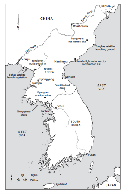
(Source: Hinge Points, Hecker and Serbin, 2023)
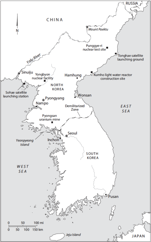
Map of the Korean Peninsula with points labeling key sites.
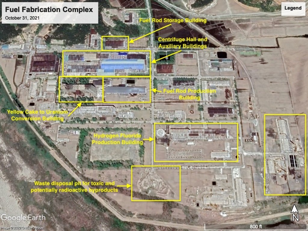
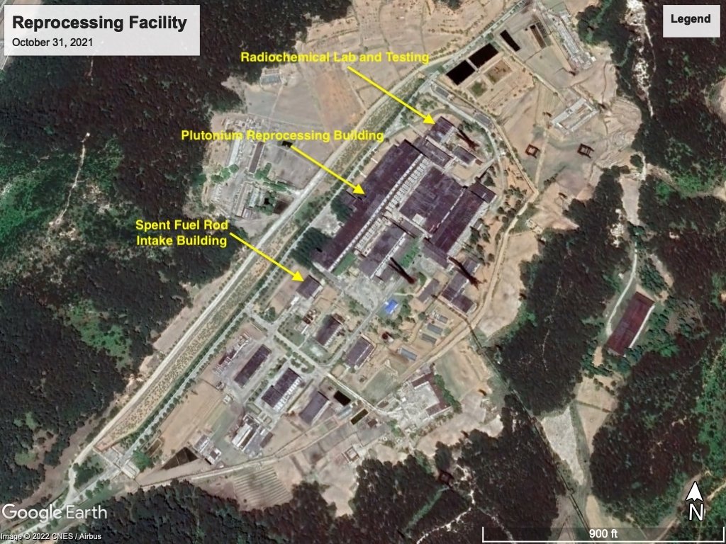
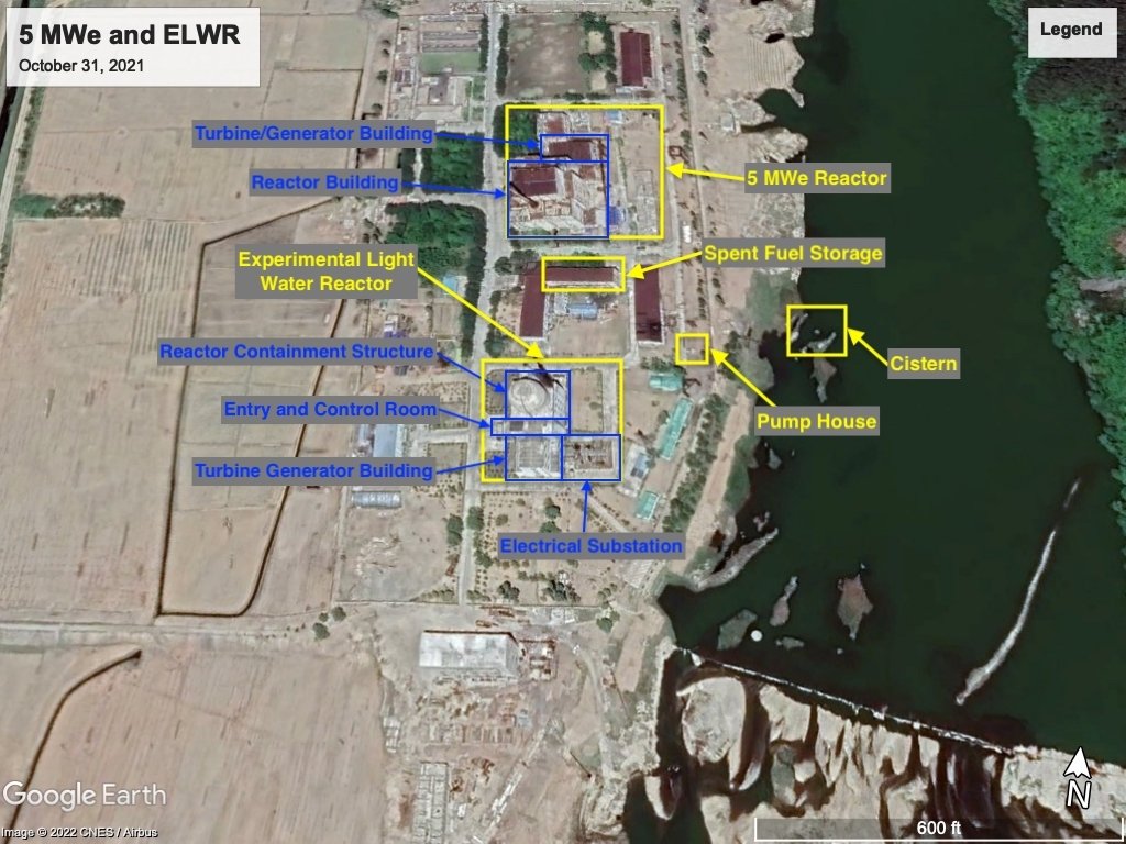
Yongbyon Nuclear Complex
The Yongbyon Nuclear Complex is the center of North Korea’s nuclear program, containing facilities for the production of nuclear fuels: plutonium and uranium. The complex includes the 5 MWe reactor, Experimental Light Water Reactor (ELWR), IRT-2000 reactor, the Radiochemical Laboratory (reprocessing facility), and fuel fabrication facilities. This satellite image from October 31, 2022 is an overhead view of the entire complex with labels on the main facilities.
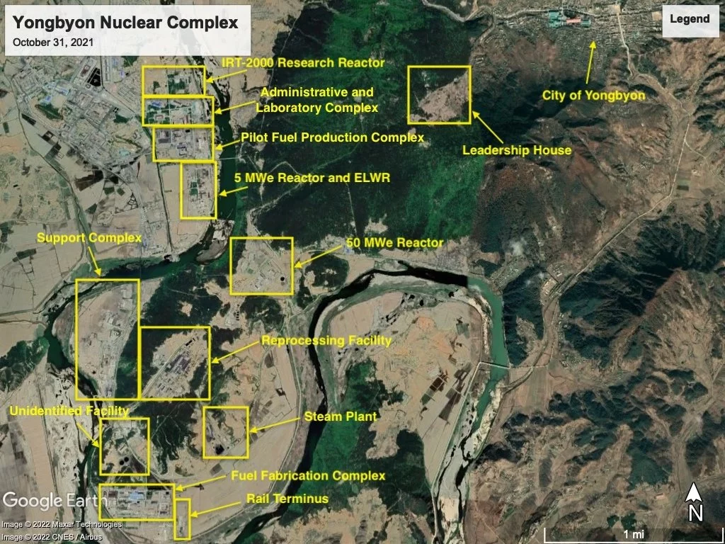
Map data: Google, ©2022 CNES, Airbus, Maxar Technologies
Facilities at Yongbyon
Map data: Google, ©2022 CNES, Airbus
Map data: Google, ©2022 CNES, Airbus
Map data: Google, ©2022 CNES, Airbus
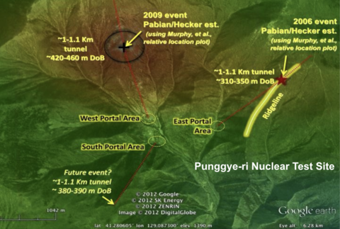
Punggye-ri Nuclear Test Site
North Korea has conducted six nuclear tests within Mount Mantap of the Hamgyong range. The test site has become eponymous with Punggye-ri, a village near Mount Mantap.
Testing a nuclear bomb requires knowledge of physics, chemistry, engineering, materials expertise, manufacturing, geology, and diagnostics. The six tests were conducted in October 2006, May 2009, February 2013, January 2016, September 2016, and September 2017. For more information, see the Weaponization section of the nuclear primer.
Explore satellite imagery and analysis of the Punggye-ri Nuclear Test Site below.
Punggye-ri Nuclear Test Site
The following images were featured in an article by Pabian and Hecker in addition to frame grabs of videos released by KCNA.
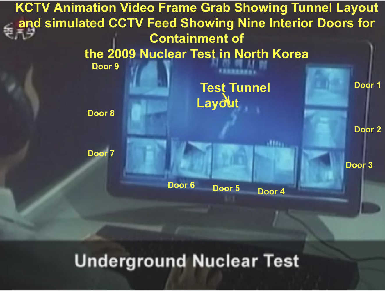
KCTV animation video frame grab showing tunnel layout and simulated CCTV feed showing nine interior doors for containment of the 2009 nuclear test in North Korea
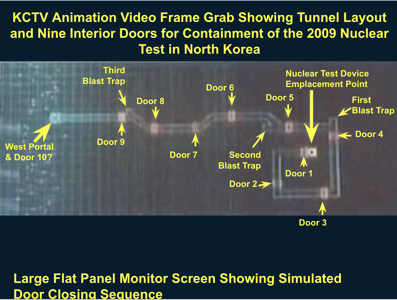
Large flat panel monitor screen showing simulated door closing sequence
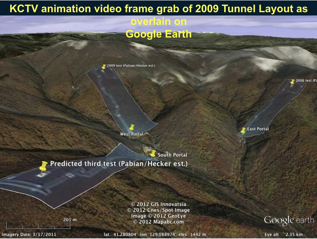
3D overhead view of three tunnel systems used for nuclear tests in the mountains
More Nuclear Facilities
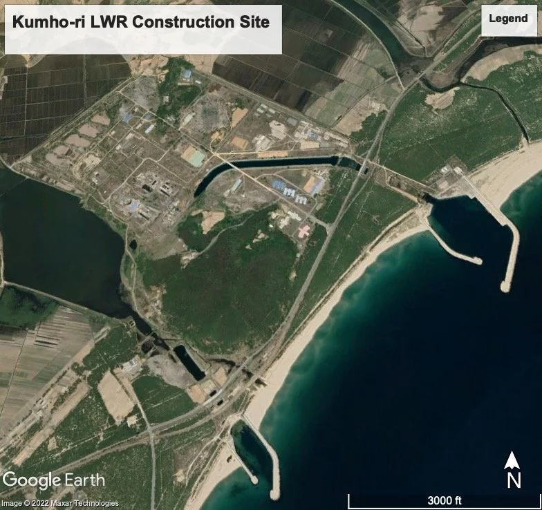
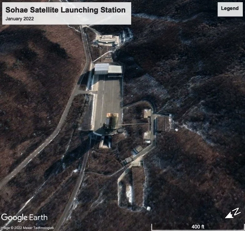
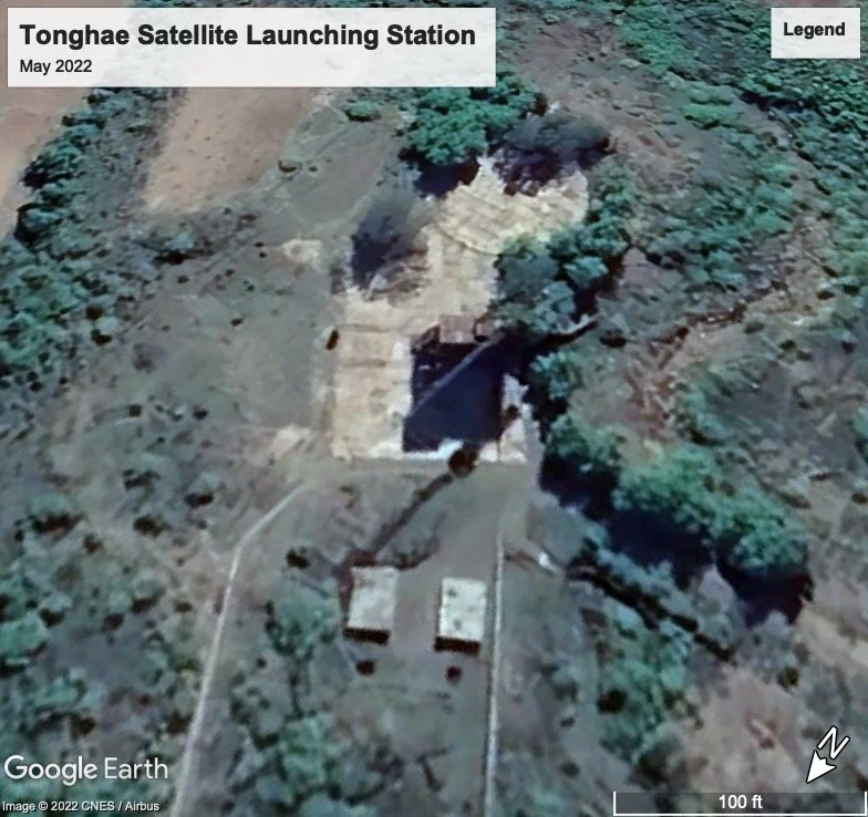
Missile Launching Sites
Historical Images
Construction of the Experimental Light Water Reactor
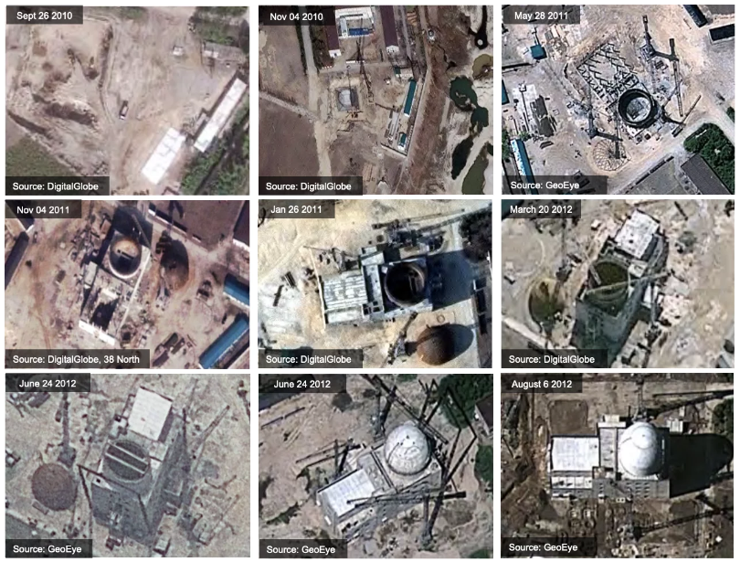
(Source: Milonopoulos, Niko, Siegfried Hecker, and Robert Carlin, “North Korea from 30,000 Feet”. Bulletin of the Atomic Scientists, January 6, 2012. https://thebulletin.org/2012/01/north-korea-from-30000-feet/.)